Where To Go
Reykjavik And Iceland's South Coast: A Two-Day Route
A short, honest itinerary for Iceland's south coast, including how far you can reasonably drive.
By Aisha Nakamura · 4 February 2026 · 8 min read
Where To Go
A short, honest itinerary for Iceland's south coast, including how far you can reasonably drive.
By Aisha Nakamura · 4 February 2026 · 8 min read
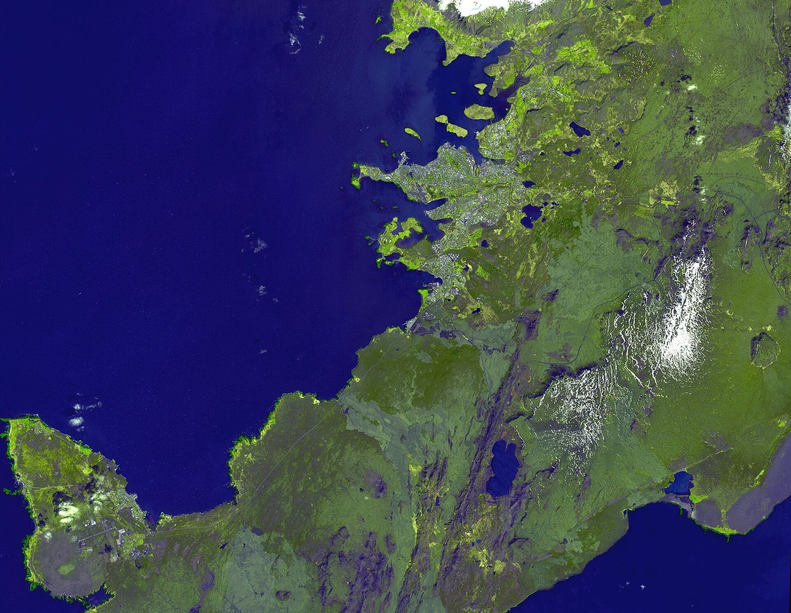
Iceland's south coast gets sold in itineraries as a tidy day trip from Reykjavik, and technically you can drive out to Vik and back in a single long day. Whether you should is a different question. The distances on paper look short, but Route 1, the ring road that carries almost all of this traffic, is a two-lane road shared with buses, trucks, sheep and, depending on the month, horizontal rain or drifting snow. This piece lays out a realistic two-day version of the route, with honest driving times, where the weather actually changes your plans, and the two hazards, sneaker waves and gravel road behaviour, that cause most of the serious incidents involving visitors each year.
Give the capital a proper morning before you get in a car. Hallgrimskirkja, the concrete church that dominates the skyline, is worth the elevator ride to the tower for a view over the coloured rooftops of the old town, and it costs a small fee that changes occasionally, so check current pricing rather than trusting an old blog post. From there it is a ten-minute walk down Skolavordustigur, one of the more photogenic streets in the city, to Laugavegur, the main shopping street, and on to Harpa, the glass concert hall on the harbour whose facade was designed with artist Olafur Eliasson and catches light differently through the day. If you have a free hour, Grotta lighthouse at the western tip of the Seltjarnarnes peninsula is a quiet spot to walk at low tide, and on a clear autumn or winter evening it is one of the more reliable places near the city to watch for the northern lights, away from streetlight glare.
Many visitors also weigh a Golden Circle detour on this first day, taking in Thingvellir National Park, where the North American and Eurasian tectonic plates visibly pull apart, along with the Geysir geothermal area and Gullfoss waterfall. It is a full day on its own, roughly three to four hours of driving plus stops, and doing it on the same day as heading south toward Vik is not realistic if you want to see either properly. Treat the Golden Circle and the south coast as two separate outings, either as a long day each or folded into a longer trip, rather than trying to string all of it together before dark.
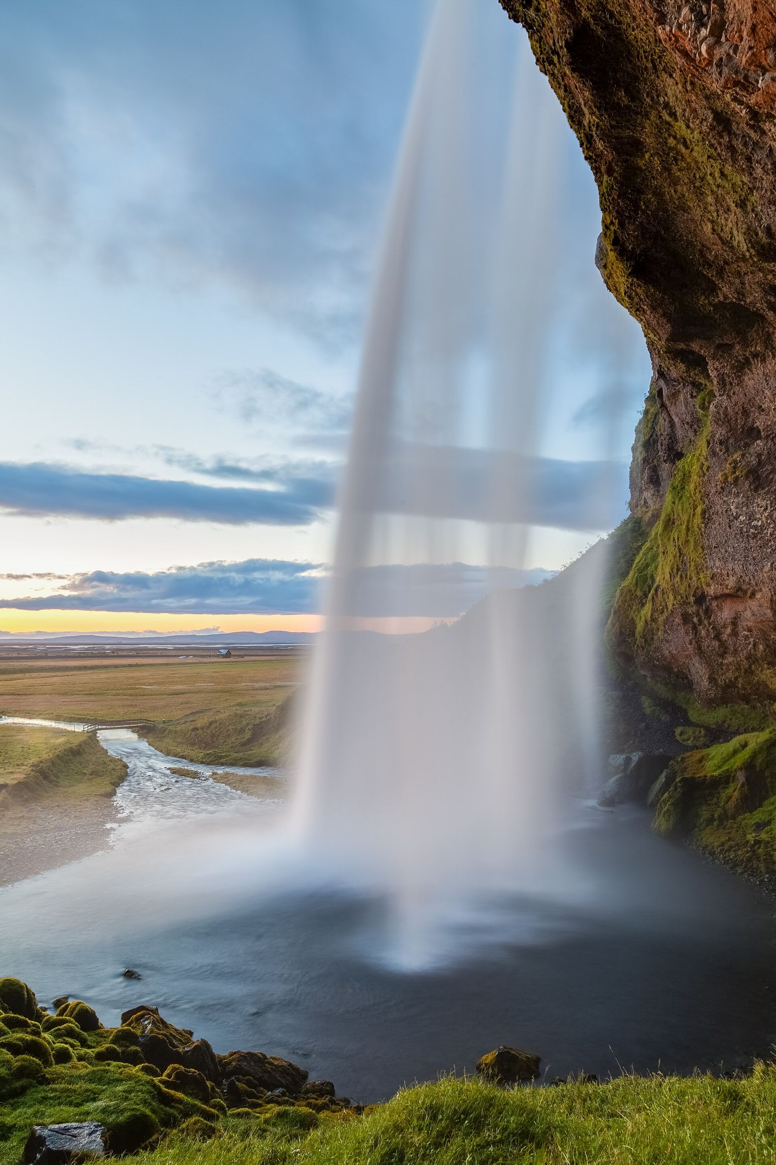
From Reykjavik, Seljalandsfoss is about 125 kilometres away, a drive of roughly an hour and forty minutes in good conditions with no stops, though almost nobody drives it without stops. The waterfall itself drops 60 metres and you can walk behind the curtain of water on a path that gets consistently, thoroughly wet, so pack a rain shell rather than relying on an umbrella. A short walk further along the cliff face brings you to Gljufrabui, a smaller waterfall partly hidden inside a canyon, which gets a fraction of the visitors Seljalandsfoss does despite being a five-minute walk away.
Skogafoss is another 30 kilometres east, about 25 minutes further, and is the more dramatic of the two for most visitors: a wide, 60-metre curtain of water you can approach at ground level or climb roughly 400 steps beside for a view down the coast. Budget an hour here if you plan to climb the stairs, since the wind at the top can be strong enough to slow you down considerably, and the steps are often wet regardless of the weather elsewhere that day.
Solheimajokull, an outlet glacier of the larger Myrdalsjokull ice cap, is a short detour off the main road, about 25 minutes from Skogafoss down a gravel access track to a car park. You can walk to a viewpoint over the glacier lagoon on your own, but getting onto the ice itself requires a guided glacier walk booked with a licensed operator, since crevasses are a real hazard and the ice has retreated and changed shape substantially over the past two decades. This is a stop to plan in advance if a glacier walk is part of your goal, since tours run on a schedule and often need booking a day or more ahead.
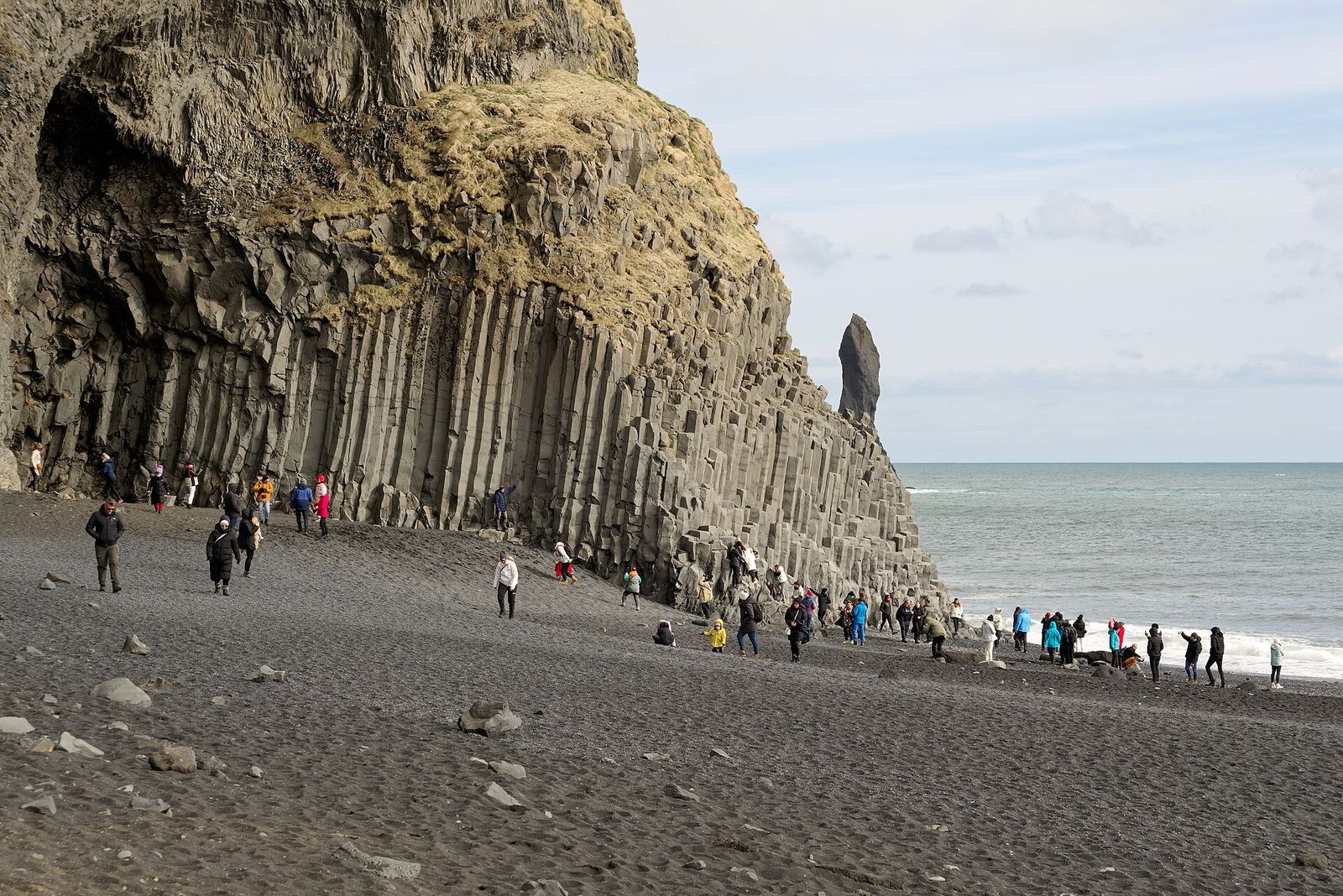
Dyrholaey, a promontory with a natural rock arch, sits about 30 minutes past Solheimajokull and offers one of the better lookout points on the coast, weather permitting; the access road up to the headland is sometimes closed during nesting season in early summer or after heavy weather, so check conditions before you commit to the detour. Reynisfjara, the black sand beach a short drive further on, is the most photographed stop on this route and also the one where caution actually matters. It faces open ocean with no offshore islands to break the swell, and so-called sneaker waves, unusually large waves that arrive without warning and travel further up the beach than the ones before them, have caused fatalities and serious injuries to visitors who walked out onto wet sand or turned their back on the water for a photograph. The basalt columns and sea stacks are worth seeing, but stay well back from the waterline, keep an eye on the sea rather than your camera, and treat any posted warning signs as current, not decorative.
Vik i Myrdal itself, Iceland's southernmost village, is about ten minutes past Reynisfjara and makes a sensible overnight base, since it sits roughly 190 kilometres from Reykjavik, close to five hours from the capital once you include the stops above rather than driving it straight through. The village has a small church on a hill above the main street that is worth the short climb for the view back over the black sand coastline, and a handful of guesthouses and a hotel or two that fill up in summer, so book ahead in the warmer months.
Daylight on this route varies enormously by season. In June you can realistically drive and sightsee past 10pm under a low midnight sun, while in December you might have five or six usable hours of daylight, meaning the same route that felt relaxed in summer needs to start early and move briskly in winter, with less flexibility for detours. Wind is the other constant variable; gusts strong enough to make a car door genuinely hard to open, or to push a car sideways at speed, are common enough along this coast that road.is, Iceland's official road conditions site, and safetravel.is, run by the Icelandic Association for Search and Rescue, are both worth checking the morning of the drive and again before you leave any stop, not just once before you leave Reykjavik. Both sites report closures, wind warnings and, in winter, ice conditions in plain language, and safetravel.is also lets you register your travel plan so search and rescue teams know where to start looking if something goes wrong.
Route 1 itself is paved the entire way between Reykjavik and Vik, which surprises some visitors who expect gravel; the gravel comes in on the access roads to specific sights, like the track down to Solheimajokull or some routes toward Dyrholaey. Gravel roads in Iceland behave differently from paved ones even at moderate speed, with a real risk of losing control if you brake hard or turn sharply, and rental cars here are commonly damaged by loose stones kicked up when passing oncoming traffic too fast, which most Icelandic rental contracts explicitly do not cover. Slow down well before you reach gravel, leave more space than feels necessary behind other vehicles, and resist the urge to keep pace with a local driver who knows the road far better than you do.
The single biggest planning mistake on this route is treating all four or five main stops as roughly equal and budgeting the same twenty minutes at each. Seljalandsfoss and Skogafoss both reward at least forty minutes if you want to explore properly, Reynisfjara deserves an unhurried walk rather than a drive-by, and a glacier walk at Solheimajokull is a half-day commitment on its own once you include the guided tour itself. If your schedule is tight, it is better to drop one stop entirely, most commonly the glacier walk or the Dyrholaey detour, than to rush all of them and arrive at each one stressed about the clock, especially with winter daylight working against you. For general help pacing a trip like this against your available days, see our guide on how to plan a trip without overpacking the schedule.
Vik is a natural stopping point for a two-day version of this route, but it is not the end of the south coast; travellers with more time often continue on toward Skaftafell and the Jokulsarlon glacier lagoon, another two to three hours further east, which turns this into a three or four day loop rather than an out-and-back. If Iceland is one stop on a longer itinerary, our guide to how to plan a multi-city international trip covers how to sequence a country like this against onward flights, and our before you go checklist is worth reviewing for what to pack given how quickly conditions here can shift. Whatever pace you choose, build in slack. The south coast punishes a tight schedule more than almost any other route in Europe, not because the distances are long, but because the weather, the light and the sheer pull to stop the car one more time rarely cooperate with a plan drawn up in advance.
Where To Go
Two full days in Rio, arranged around the bay, the beaches and the hills, with realistic travel times between them.
8 min read
Where To Go
A first trip to Japan works best as a line, not a loop: Tokyo, one detour, then Kyoto.
8 min read
Where To Go
Europe's quieter cities reward the traveller who is willing to change trains once more.
10 min read